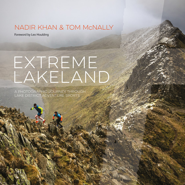

Sam Farnsworth and Will Nicholls (of Gaia Adventures) shares their thoughts about avalanches - in particular, how to interpret and understand avalanche forecasts.
When I started winter mountaineering, I found the avalanche forecast confusing, and in particular, the hazard levels. The forecast informs us as to how likely avalanches are to occur for that day, and the risk (or hazard) is rated as the following: Low, Moderate, Considerable, High and Very High. But to me, these were all just words on a page. They didn’t mean anything. I’d see people walking on steep snow slopes which were given 'Considerable' or 'High,' and I'd wonder how they knew they weren’t going to be avalanched.
Since then, I’ve spent hundreds of days in the snow, both personally and professionally; walking, climbing, and skiing. With more experience, input from avalanche courses and discussions with friends and colleagues, I eventually realised that people couldn’t know whether or not a slope was going to avalanche, as nobody can. Whether they understood the risks of what they were doing or not is a different matter. Reading, understanding and applying the avalanche forecasts is the best way of staying safe in a winter environment. I hope what’s described below may help with your understanding, and keep you safe.
Avalanche education is a massive subject. It’s easy to get sucked into thinking about snow crystals, how they change, and how weather affects the snowpack. It can quickly become overwhelmingly complex. It doesn’t need to be. We can leave this to the professionals working for the Scottish Avalanche Information Service, who do an excellent job of figuring all of this out for us by creating forecasts. All we need to do is apply what they’re telling us..
Before we go any further, let’s bear in mind that 90% of avalanche victims trigger their own avalanches. This means they’re not totally random or unpredictable events, they’re generally the result of our actions. Most accidents occur on considerable forecasts. And then moderate. Why? Because it’s unlikely to trigger an avalanche on a low hazard day, and forecasts of high and above sound too terrifying, so people stay in the pub!
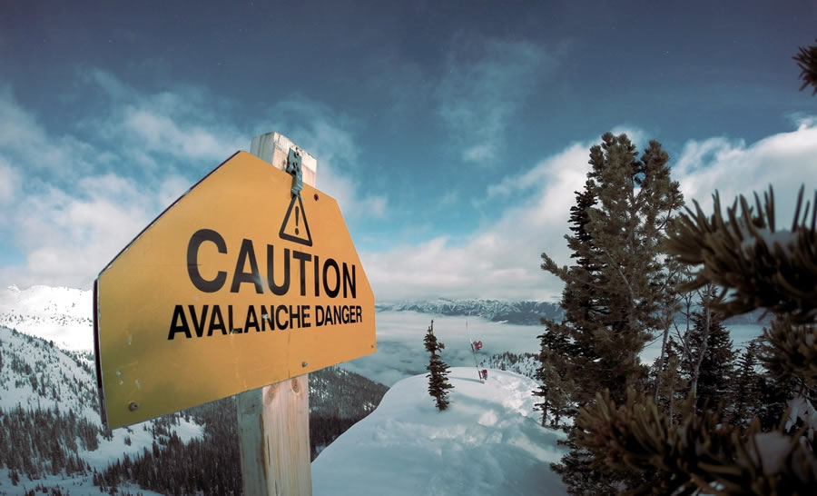
Let’s use an analogy of crossing a motorway as akin to going into avalanche terrain on a mountain. Avalanche terrain can be thought of as anywhere that an avalanche could occur or run out as it descends the mountain, anywhere that we’re at risk. Slopes of 30° to 45° are the most likely to slide. This is exactly where winter walkers, mountaineers and skiers like to hang out. Approach slopes and exit pitches on winter climbs are often this gradient.
It’s vital to know the steepness of the slopes we intend to venture onto, and those above us. We may well be on flat ground, but if dangerous conditions exist on steep slopes above us, we could still be avalanched, even though we haven’t triggered it. Where we go dictates the likelihood of being avalanched - and remember - we have complete control over where we go, and when we go there.
Back to the analogy.
I’d like you to imagine crossing a motorway on foot. Unappealing right? When would you most like to cross it? When would you least like to cross it?
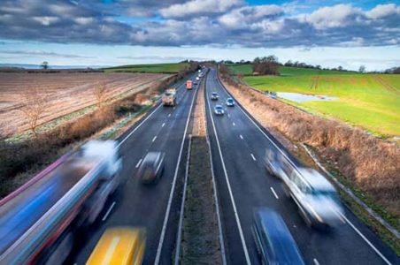
Does it look like a good time to cross in the image below?
Not a good time to cross!
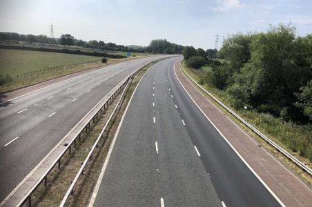
I imagine you’d prefer to cross in the early hours of the morning. It’s quieter, so you’re less likely to be hit by a vehicle.
I doubt there would be many takers to cross during rush hour. It’s busier, so you’re much more likely to be be hit by a vehicle. It seems fairly quiet, but we don’t know what’s coming…!
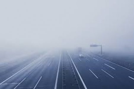
Now imagine crossing in fog. Crazy huh?! Even during the quieter times it’d feel risky. Rush hour would be unacceptably dangerous wouldn’t it? You wouldn’t be able to see what’s coming, so you wouldn’t be able to reduce the risk by waiting for cars to pass.
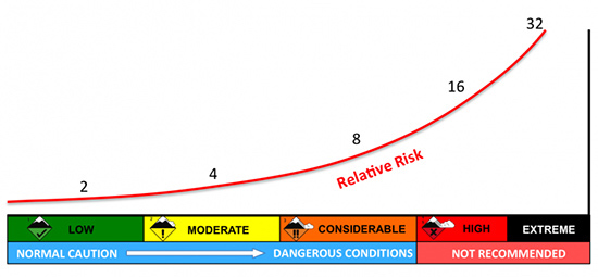
We can draw a parallel with venturing into avalanche terrain. A snowslope that’s steep enough to slide (generally 30° to 45°) could be really quite safe one day, and death-on-a-stick another. The avalanche forecast tells us just how dangerous they are on a given day. It’s important to understand that the difference between the hazard levels is significant. The relative risk doubles each time, as this graphic, courtesy of the Utah Avalanche Center shows. (Substitute Extreme for Very High - they’re the same)
Crossing the motorway at the quietest time could be akin to a low avalanche hazard.
Crossing it during the busier times would equate to considerable and above.
Crossing in the fog is the same as walking into avalanche terrain with poor visibility.
There’s always a chance of being hit by a vehicle when you cross a motorway - but sometimes you’re asking for it. Whenever snow is present in avalanche terrain, there’s a risk of being avalanched. Sometimes it’s very unlikely, while at others it’s almost certain. Sometimes you’re asking for it. Acknowledge this and it becomes obvious.
Venturing into avalanche terrain is about being patient. We just need to wait till conditions are favourable for where we want to go. This means low avalanche risk, good visibility and good weather. As an example, you may want to climb a route in Coire na Ciste on Ben Nevis. There are many snowslopes of 30° to 45°, it is most definitely avalanche terrain.
The coire has aspects of North, North East, and East. If an avalanche was triggered here, it could run down to the CIC hut at 650 metres.
If the avalanche hazard was low for N, NE, and E slopes above 650 metres, you had good visibility and good weather, then going there would be a good plan.
If the avalanche hazard was considerable for N, NE, and E slopes above 650 metres, then going there would be a bad plan. If you were avalanched it would hardly be a surprise.
So what do you do? Go somewhere else! Find somewhere that is safe. It’s the equivalent of looking for a bridge over the motorway. We don’t need to expose ourselves to high levels of risk. Sometimes conditions just don’t allow us to access certain areas safely. We might need to wait for another season until they do. That’s just mountaineering!
Remember, we don’t need to cross the motorway. If you’re unsure, go to non-avalanche terrain and stick to safe aspects.
I write this as someone who’s made a really poor decision before, and luckily managed to get away with it. It still haunts me. We went to a slope of roughly 38°, with a considerable hazard level. Can you guess what happened? We triggered an avalanche. Not very surprising is it? We chose the wrong slope at the wrong time.
In conclusion;
- We cannot change the weather.
- We cannot change the snowpack and avalanche hazard.
- We can choose where we go and when.
This is what keeps us safe.
Some excellent resources;
The Scottish Avalanche Information Service website is the go-to for avalanche forecasts in Scotland.
Bruce Tremper’s terrain management video explains how various factors must be balanced to have a day with an acceptable level of risk.
This video, made by the USA’s National Avalanche Center shows what the article is all about.
The Fatmap website makes planning a day really straightforward. It allows you to see how steep the slopes are in the area you’re thinking of visiting.
Sam Farnsworth and Will Nicholls run Gaia Adventures, an outdoor company based in North Wales.